
Bond Albedo Map of Europa
The Bond albedo was determined in our article DOI 10.1051/0004-6361/202453058 for 20 regions of interest (ROIs) based on Voyager and New Horizons data using Hapke parameters. By correlating these values with the average pixel intensities for each ROI on the USGS map, we determined a linear relationship between the Bond albedo and pixel intensity.
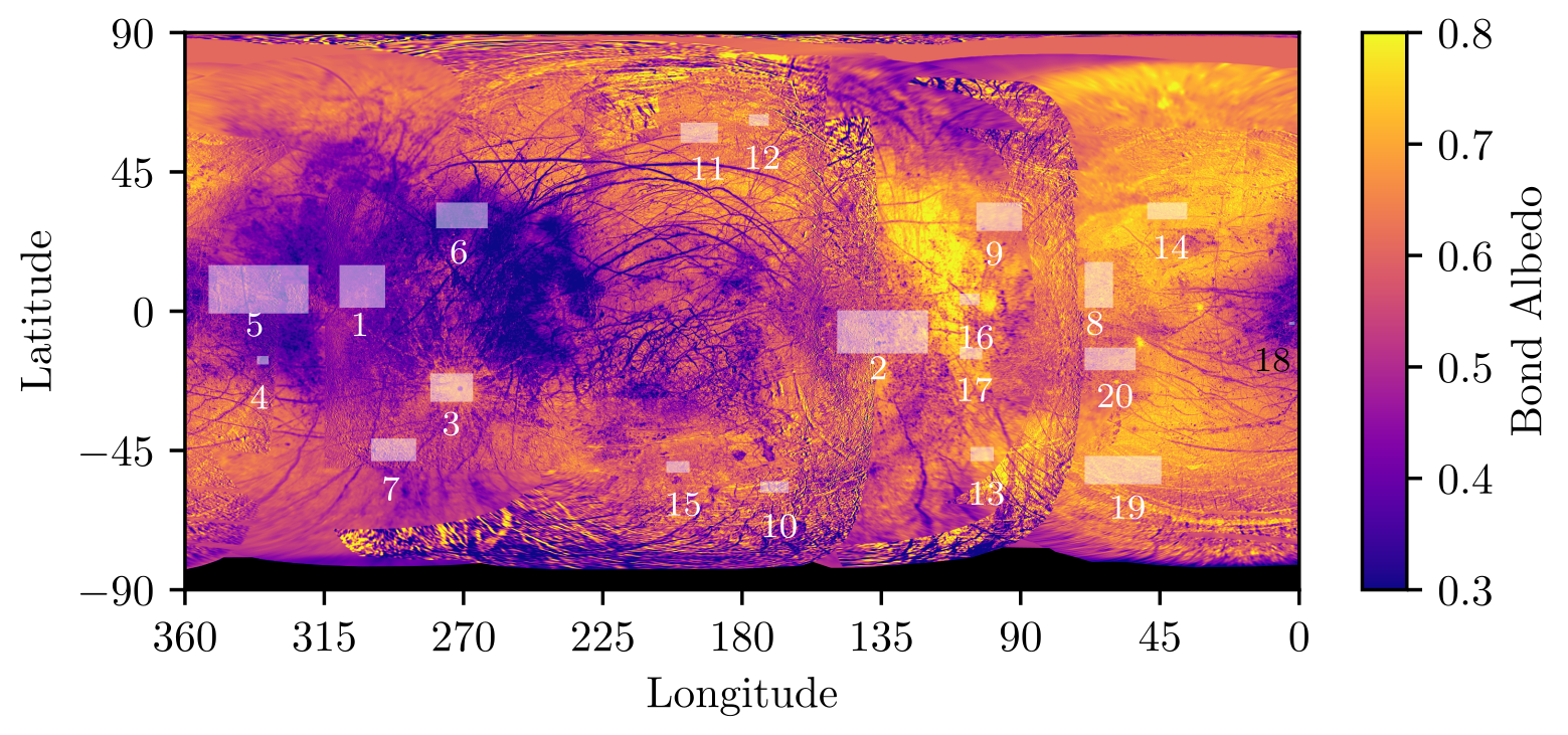
The Bond albedo map produced in our paper is available in the IPSL Data Catalog at DOI 10.14768/d302ffb6- ef72-4f91-a592-ff2b644aaf77.